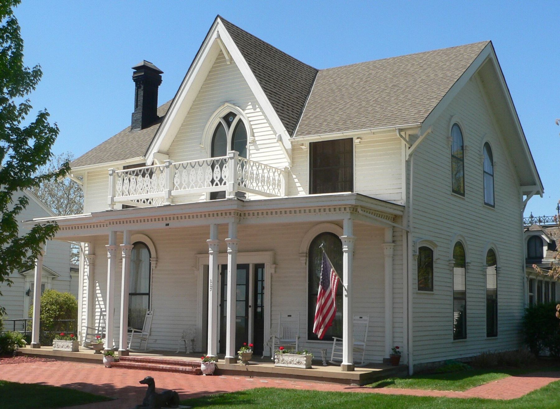
Atchison sits on the Kansas side of the Missouri River, about 50 miles northwest of downtown Kansas City and some 20 miles up the river from Weston. The town climbs a set of steep bluffs above a bend in the river, and the houses on those bluffs tell the story of a place that grew rich fast in the second half of the nineteenth century.
A border town of 1854
Atchison was founded in 1854, the year Congress opened the Kansas Territory and left the question of slavery to its settlers. The town was laid out by proslavery men from Missouri and named for David Rice Atchison, a United States senator from Missouri and one of the loudest voices for carrying slavery into Kansas. Its early newspaper was fiercely proslavery, and the town was part of the violent struggle that became known as Bleeding Kansas.
The balance shifted within a few years. Free-state settlers arrived in growing numbers, the old leaders lost control, and Kansas entered the Union as a free state in 1861. Atchison's early history is a direct part of the same border conflict that ran through Weston, Leavenworth and the river counties of Missouri, and it is worth keeping in mind as you walk the town.
The railroad town
Atchison's site on a westward bend of the Missouri made it a natural place to start overland freight, and after the Civil War it became a railroad town. The Atchison, Topeka and Santa Fe Railway, chartered in 1859, took its name from the town, though the line's main growth came later and farther west. Several other railroads met here, and grain, freight and passengers moved through in large numbers in the decades after the war.
The money from that trade built the town you see on the bluffs. Merchants, bankers and rail men put up large brick and frame houses in the styles of the 1870s, 1880s and 1890s, many with towers, deep porches and ornate trim. The streets north and south of downtown hold dozens of them.
Amelia Earhart's birthplace
The best-known house in town is a white Gothic Revival home at 223 North Terrace Street, on a bluff above the river. Amelia Earhart was born there on July 24, 1897, in the home of her grandparents, and spent much of her early childhood in the house. She went on to become one of the most famous aviators of the century, the first woman to fly solo across the Atlantic, before she disappeared over the Pacific in 1937.
The house is now the Amelia Earhart Birthplace Museum, with rooms furnished in the period and exhibits on her life. Visiting hours and admission change, so check before you go. Even if it is closed, the view from the street over the river is worth the climb.
The town has other reminders of her, including a bridge. The highway bridge across the Missouri at Atchison, opened in 2012 to replace an older span, is named the Amelia Earhart Memorial Bridge.
Downtown and the bluffs
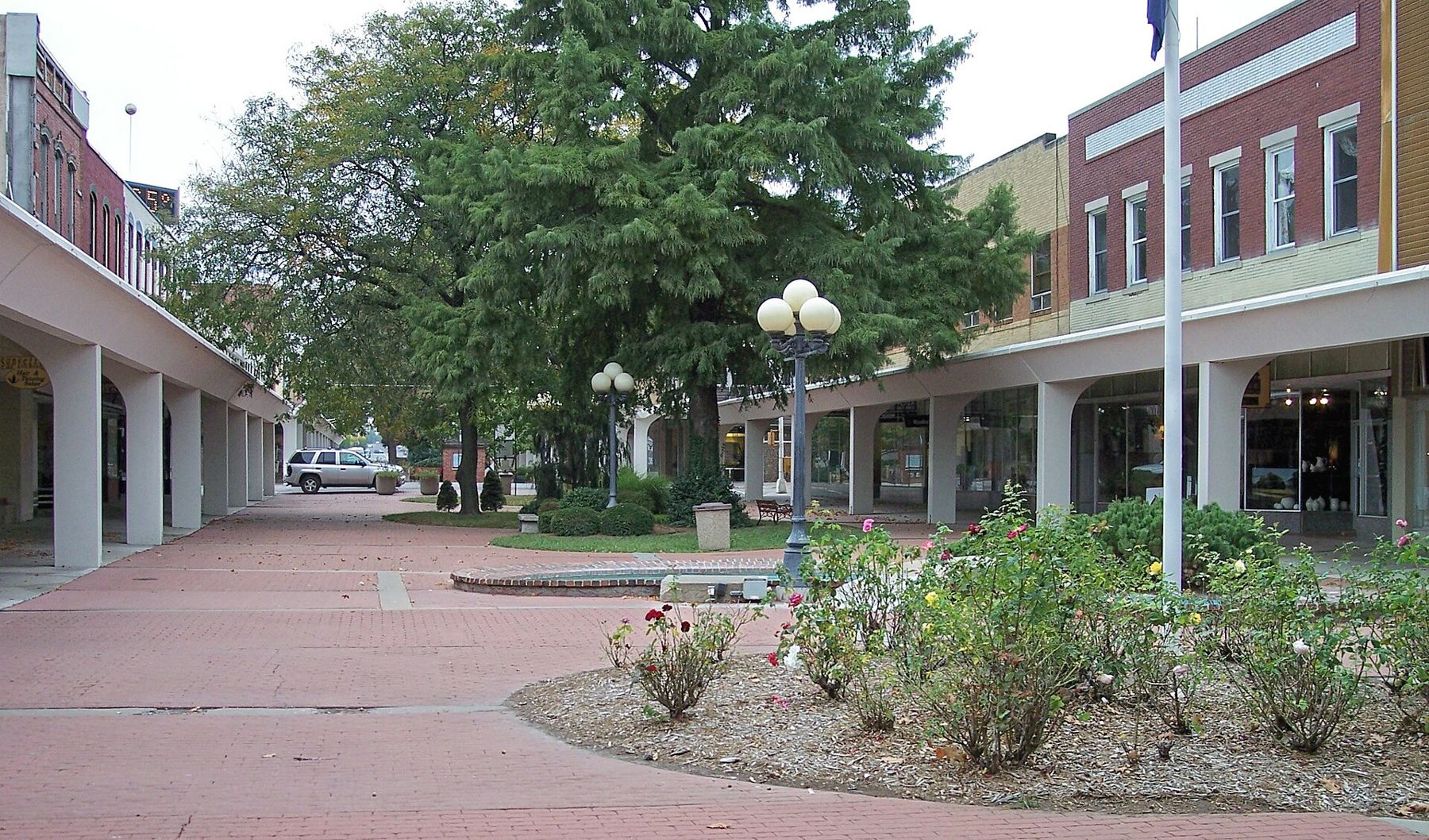
Downtown Atchison is centered on Commercial Street, where several blocks were turned into a pedestrian mall in the 1960s, with covered walks, plantings and benches. Around it stand many of the town's older commercial buildings in brick and stone. It is a pleasant place to walk, and a good place to look up at the cornices and upper floors.
From downtown, the streets climb steeply toward the bluffs. To the north, the campus of Benedictine College and St. Benedict's Abbey stand on high ground above the river, and the Benedictine monks and sisters have been part of the town since the 1850s and 1860s. The bluff roads give wide views over the river and the bottoms on the Missouri side.
Atchison also has a long tradition of telling stories about its old houses, and many of the large Victorian homes are known by the names of the families who built them. Some are open for tours on certain days or during seasonal events, while most remain private homes. Look from the sidewalk, respect the residents, and check locally for any house that is open on the day you visit.
Lewis and Clark at Independence Creek
Long before the town, the Corps of Discovery passed this bend. On July 4, 1804, Lewis and Clark's party camped near the mouth of a creek just north of present Atchison and named it Independence Creek in honor of the day. You can read more about their passage on this stretch of the river. A small trail and marker near the creek recall the camp; check local information for access.
Getting there from Weston's side of the river
From Weston, the drive north along the Missouri side of the river runs through farm country and past bluffs before crossing at Atchison. From Kansas City, you can also come up through Leavenworth on the Kansas side, which makes a loop of the river towns possible in a long day. Upriver on the Missouri side, St. Joseph is about 20 miles farther on.
- Time: half a day covers the birthplace, a walk downtown and a drive along the bluffs.
- Season: spring and early fall are the best for walking the steep streets and seeing the houses.
- Hours and fees: the birthplace museum and other sites set their own schedules, which change. Check before you go.
Wear good shoes. Atchison's streets are among the steepest on this stretch of the river, and the best views are at the top of them.
Notice
Notice: Victorian houses climb the bluffs above the Missouri. See the house where Amelia Earhart was born, then walk Commercial Street in spring or fall.