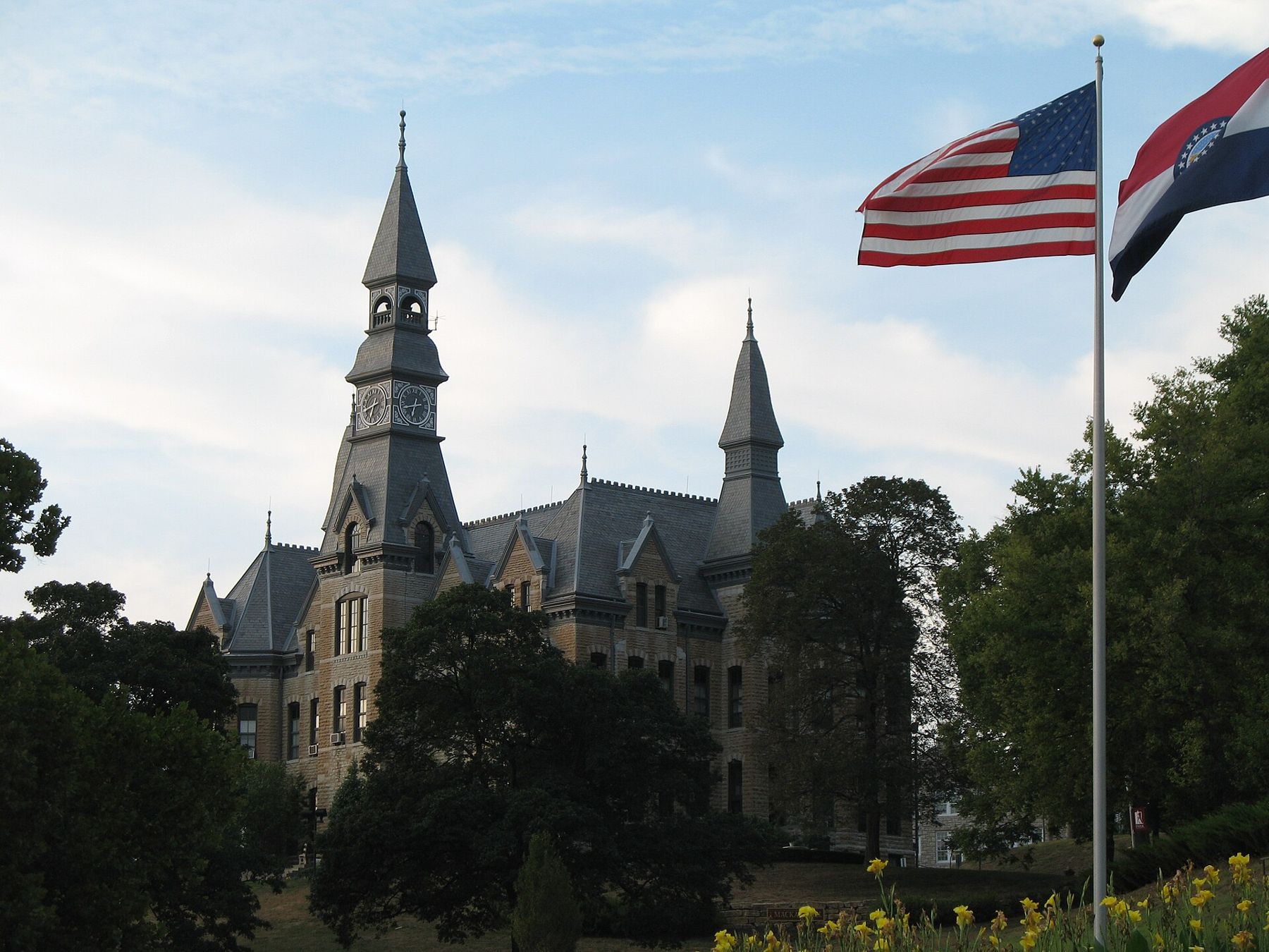
Parkville sits where a line of limestone and loess bluffs comes down close to the Missouri River, about 12 miles northwest of downtown Kansas City. The old town is squeezed onto a strip of bottomland between the bluffs and the water, with a college on the hill above it. It is a small place, but its story covers most of the themes of this stretch of the river: a steamboat landing, the fight over slavery, a college raised by its own students, segregated schooling, and floods that keep coming back.
A landing below the bluffs
Before there was a town, the site was a river landing known as English's Landing, a place where steamboats could tie up beneath the bluffs. After the Platte Purchase opened the land north of the river to settlement in 1837, George S. Park bought ground here and laid out a town in the 1840s, naming it after himself. Parkville grew as a shipping point for the hemp, tobacco, grain and livestock of southern Platte County.
The old name survives in English Landing Park, the long riverfront park at the foot of downtown. Lewis and Clark's party worked up past this bend in the summer of 1804, a few days after leaving their camp at the mouth of the Kansas River, as told in Lewis and Clark on this stretch of river. Fifty-two years later the steamboat Arabia went down in the river not far from town, and her recovered cargo is now in Kansas City, the subject of the steamboat that sank in a cornfield.
A newspaper in the river
Park was a town builder with firm opinions. In the 1850s he published a newspaper in Parkville that took a free-soil line, opposing the spread of slavery into the new Kansas Territory just across the river. Platte County was slave country, and feeling ran high as proslavery Missourians crossed the river to vote and fight in the territorial elections. In April 1855 a proslavery mob wrecked the newspaper office and threw the press into the Missouri River. Park was threatened with death and left the county for a time.
“In April 1855 a proslavery mob wrecked the newspaper office and threw the press into the Missouri River.”
The attack was one of many acts of violence along the border in the years before the Civil War, and it shows how near the surface that conflict ran in the river towns. Parkville, like Weston and the rest of Platte County, went through the war years under federal occupation, with raids, arrests and divided loyalties in nearly every family.
The college on the hill
After the war Park returned, and in 1875, with the Presbyterian minister John A. McAfee, he founded Park College on the bluff above the town. The college ran on a work program: students paid for much of their schooling by working for it, farming its land, running its kitchens and putting up its buildings.
The best-known result is Mackay Hall, the main building of what is now Park University. Students quarried the stone from the hill and raised the building themselves over several years in the late 1880s and early 1890s. With its tall clock tower and steep slate roofs, it looks down over the town and the river, and it is listed on the National Register of Historic Places. The grounds are pleasant to walk; respect classes and offices, and check with the university about going inside any building.
Park College became Park University in 2000. It now teaches students at campus centers on military bases across the country and online, but the hilltop in Parkville remains its home.
The Banneker School
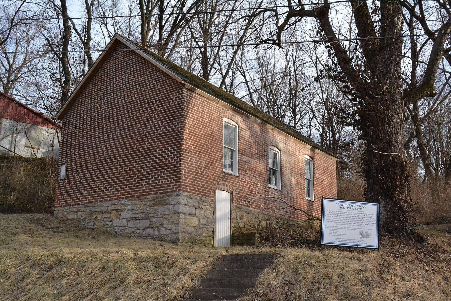
On a slope a short walk from downtown stands a small one-room brick schoolhouse on a stone foundation. This is the Benjamin Banneker School, built in the late nineteenth century as the school for Parkville's Black children in the years when Missouri law required separate schools. It is named for Benjamin Banneker, the free Black astronomer, surveyor and almanac maker of the eighteenth century.
Schools like this once stood in many Missouri towns, and few survive. The Banneker School is listed on the National Register of Historic Places, and a sign in front tells its history. It is a modest building, but it says a great deal about the town and the state in the generations after emancipation. You can see it from outside at any time; check locally for days when it is open.
Old downtown and English Landing Park
Downtown Parkville is a few blocks of nineteenth- and early twentieth-century buildings along Main Street and the streets just off it, between the bluff and the railroad tracks. The ground floors hold small businesses whose names change often. Walk the blocks slowly and look at the brick fronts and cornices, and at the houses stacked up the slope behind them.
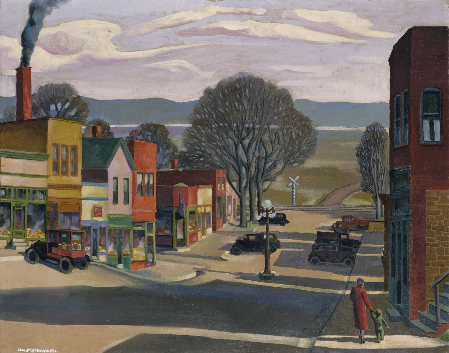
In the 1930s a painter set down this same view of Main Street running toward the river, with a railroad crossing at the bottom and the hills of the far shore beyond, under a federal program that paid artists to record American life during the Depression. The painting is now in a national museum collection, and the layout of the street is still easy to recognize.
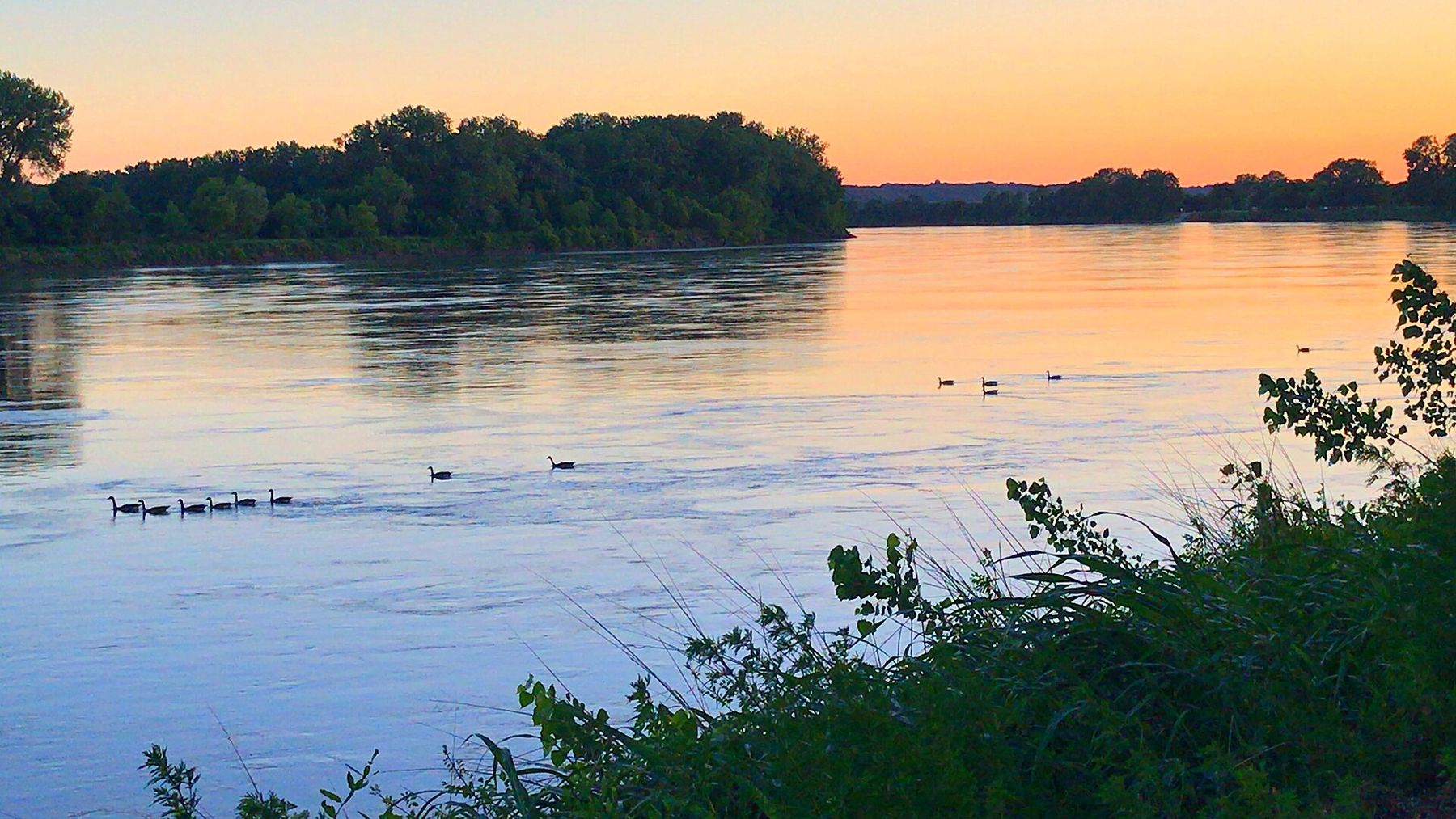
On the far side of the tracks, English Landing Park runs along the river for a long stretch. It has a paved trail for walking and biking, open lawns, picnic shelters and benches by the water. Toward evening it is one of the best places near Kansas City to watch the Missouri: geese and herons along the banks, a towboat pushing barges now and then, and the sun going down behind the trees on the far bank.
Floods at the foot of the bluff
The price of a riverfront town is high water. Downtown Parkville and English Landing Park sit on the floodplain, and the Missouri has covered them many times. The river came into the lower town in the great flood of 1993. In June 2011, when the dams upstream released record amounts of water after a winter of heavy snow, residents and city crews built long walls of sandbags to protect the downtown. High water came again in 2019.
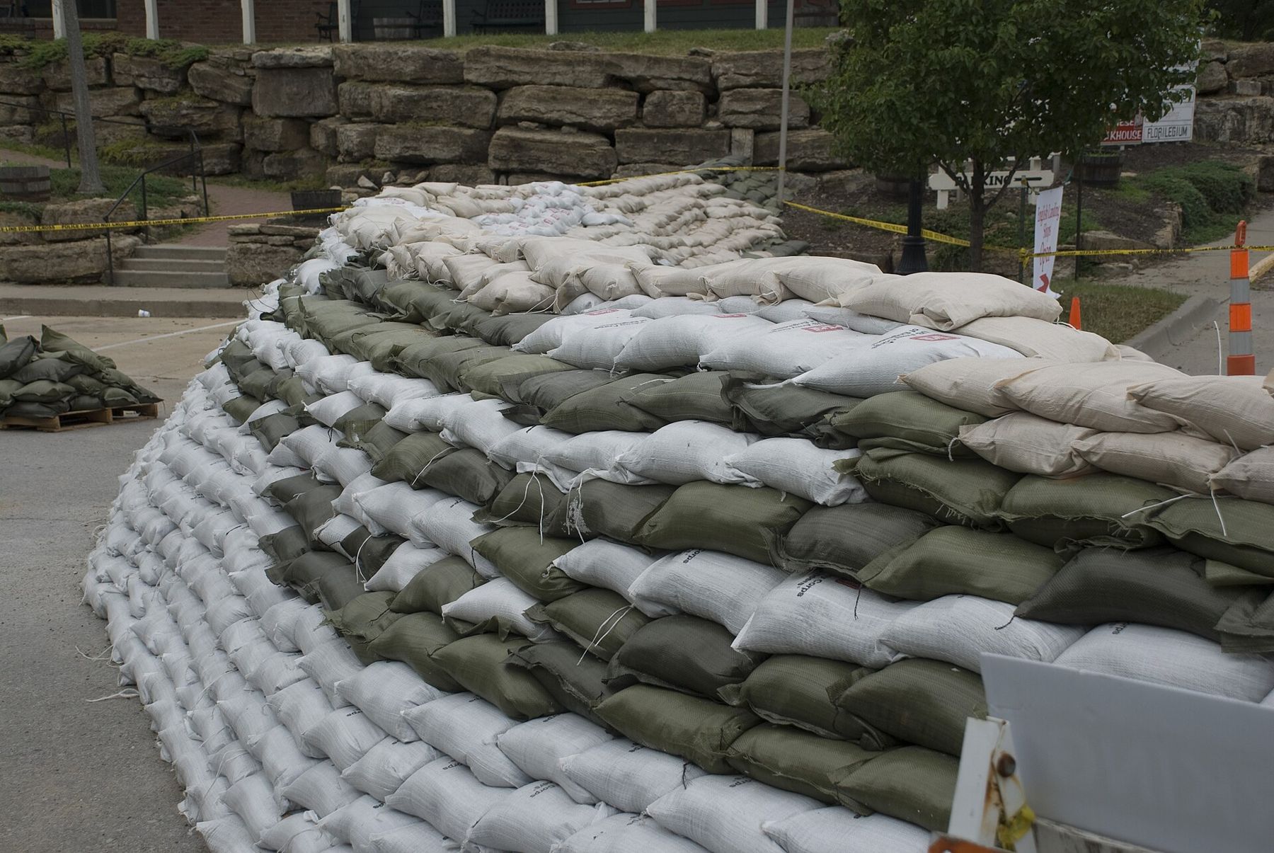
The floods explain the shape of the town: business on the low ground near the old landing, houses and the college up the slope, and a park rather than buildings along the river itself. The longer story of the Missouri's floods is told in Floods, levees and a river that moved.
Planning a visit
- Getting there: Parkville is about 20 minutes from downtown Kansas City by Highway 9 north.
- Time: half a day for downtown, the college hill and a walk along the river.
- Season: spring and fall are best. Parts of the riverfront close when the water is high.
- Hours and access: the university, the park and local events all set their own schedules. Check before you go.
Parkville pairs well with a day in the city or with the drive north along the bluffs to Weston, another river town shaped by the same water.
Notice
Notice: a stone college hall stands above the old town, and a long park runs beside the Missouri. Walk the riverfront at dusk in spring or fall.