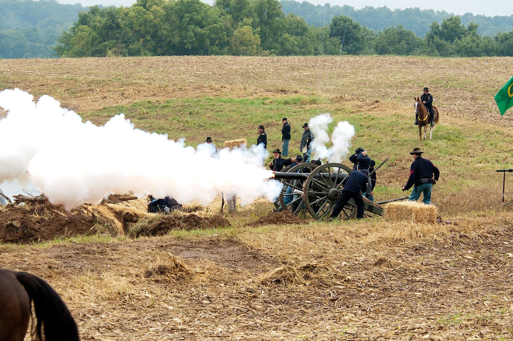
Lexington sits on a high loess bluff on the south bank of the Missouri River, about 45 miles east of Kansas City by road. In the 1850s it was one of the busiest towns on the river, and in September 1861 it was the scene of one of the stranger battles of the Civil War. You can walk the ground in an afternoon, and the town around it still shows the wealth that made it worth fighting over.
A hemp town in Little Dixie
Lafayette County lay at the western end of the band of Missouri River counties known as Little Dixie, settled largely by families from Kentucky, Tennessee and Virginia who brought enslaved people with them. By 1860 enslaved men, women and children made up roughly a third of the county's population, one of the highest shares in the state. Their labor grew and broke the hemp that was Lexington's main crop.
Hemp was hard, dirty work. The stalks were cut, left to rot in the fields through the winter, then broken and cleaned by hand. The fiber went into rope and the coarse bagging that bound cotton bales in the Deep South, so Lexington's fortune was tied directly to the cotton economy. Steamboats loaded the bales at the landing below the bluff, and the profits went into the brick houses, churches and colleges that line the upper town.
That history matters to the battle. Missouri stayed in the Union in 1861, but much of its river country leaned hard toward the South, and the governor, Claiborne Fox Jackson, had sided with secession. When federal troops drove him out of the capital that summer, the pro-Southern Missouri State Guard under Sterling Price moved north toward the river, and Lexington, with its money, its river landing and its sympathies, was the obvious target.
The siege of September 1861
The Union garrison, a few thousand men under Colonel James A. Mulligan, much of it from his Irish Brigade of Chicago, dug in on the grounds of the Masonic College on the north side of town. They threw up earthworks around the college building and held the Anderson House, a large brick home on the slope below, as a hospital.
Price's army, far larger but poorly equipped, arrived on September 12 and closed the ring over the following days. The Guard cut the garrison off from the river and from the springs below the bluff, and the defenders soon ran short of water in the late-summer heat. The Anderson House changed hands more than once in hard fighting, and the treatment of wounded men there became a bitter point afterwards.
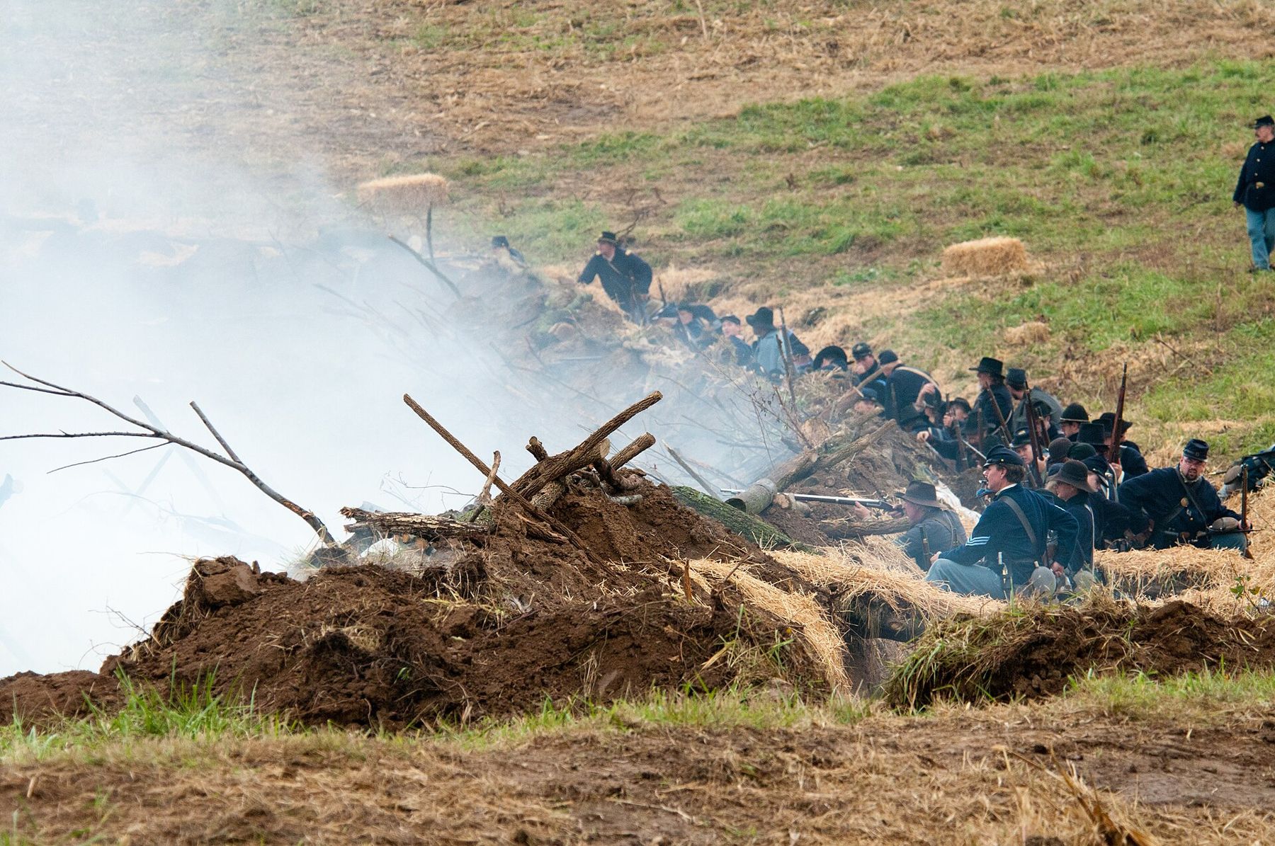
The famous moment came on September 20. Guardsmen took hemp bales from the warehouses along the river, soaked them so they would not catch fire from heated shot, and rolled them up the hill in front of them as a moving breastwork. Rifle fire sank into the packed fiber. As the line of bales crept closer to the works, Mulligan's position became hopeless, and that afternoon he surrendered.
“Rifle fire sank into the packed fiber.”
The victory gave the Confederacy a brief lift in Missouri, but Price could not hold the river. Within weeks he fell back toward the southwest corner of the state, and federal troops returned. Lexington saw a second, smaller fight in October 1864, during Price's last raid across Missouri, before the war in the region ended in raids, reprisals and the long bitterness of the border.
Walking the battlefield
The Battle of Lexington State Historic Site covers the siege ground on the north edge of town. A visitor center tells the story with maps and artifacts, and a loop of paths crosses the open field where the earthworks stood. Some of the trench lines can still be traced as low ridges in the grass. Interpretive markers stand along the way, and the bluff edge gives a long view over the river bottoms, which helps you see why cutting the garrison off from the water was so effective.
Every few years, around the anniversary in September, reenactors stage the battle on or near the old ground. The dates vary, so check the state park calendar before you plan around one.
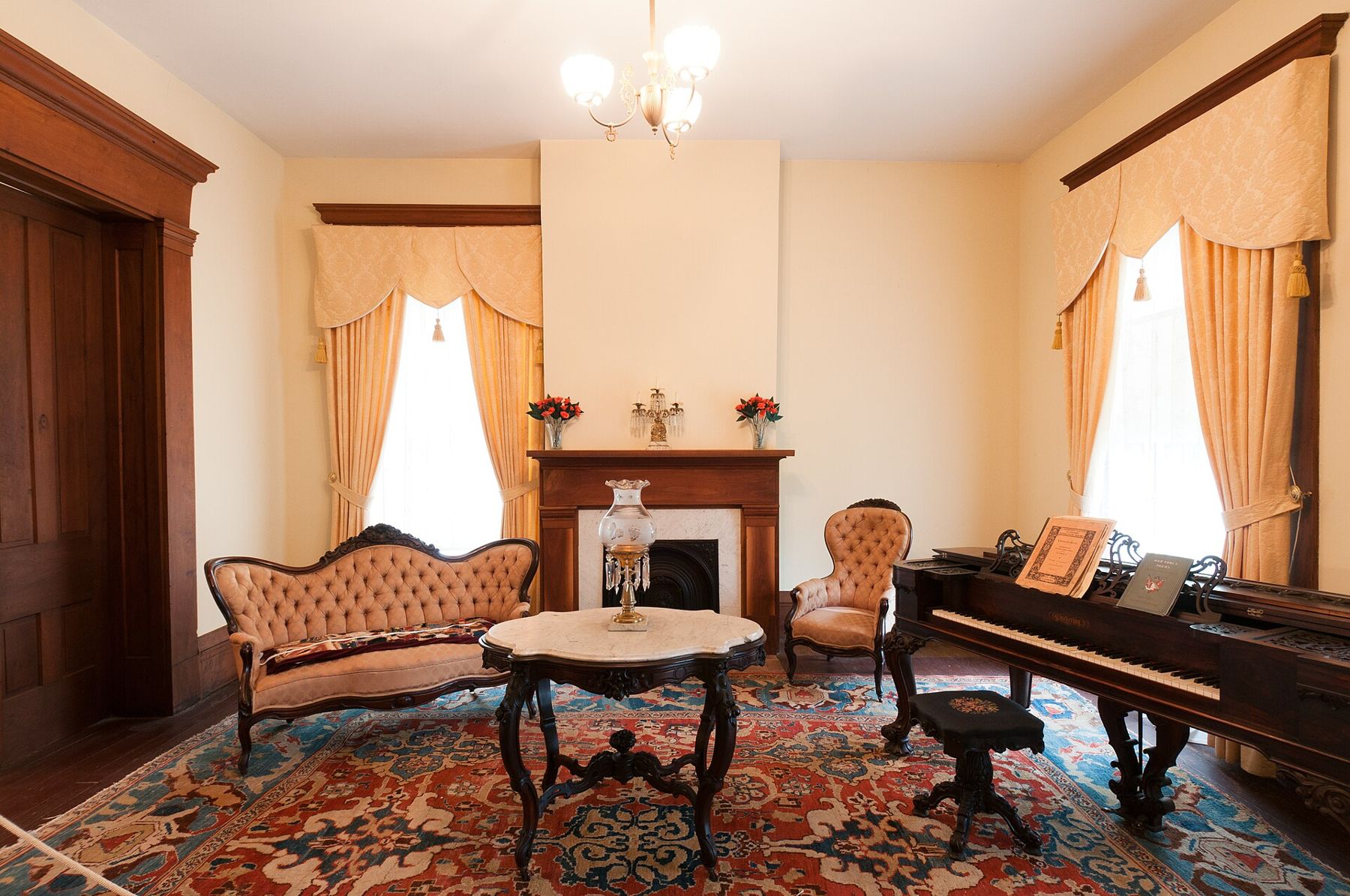
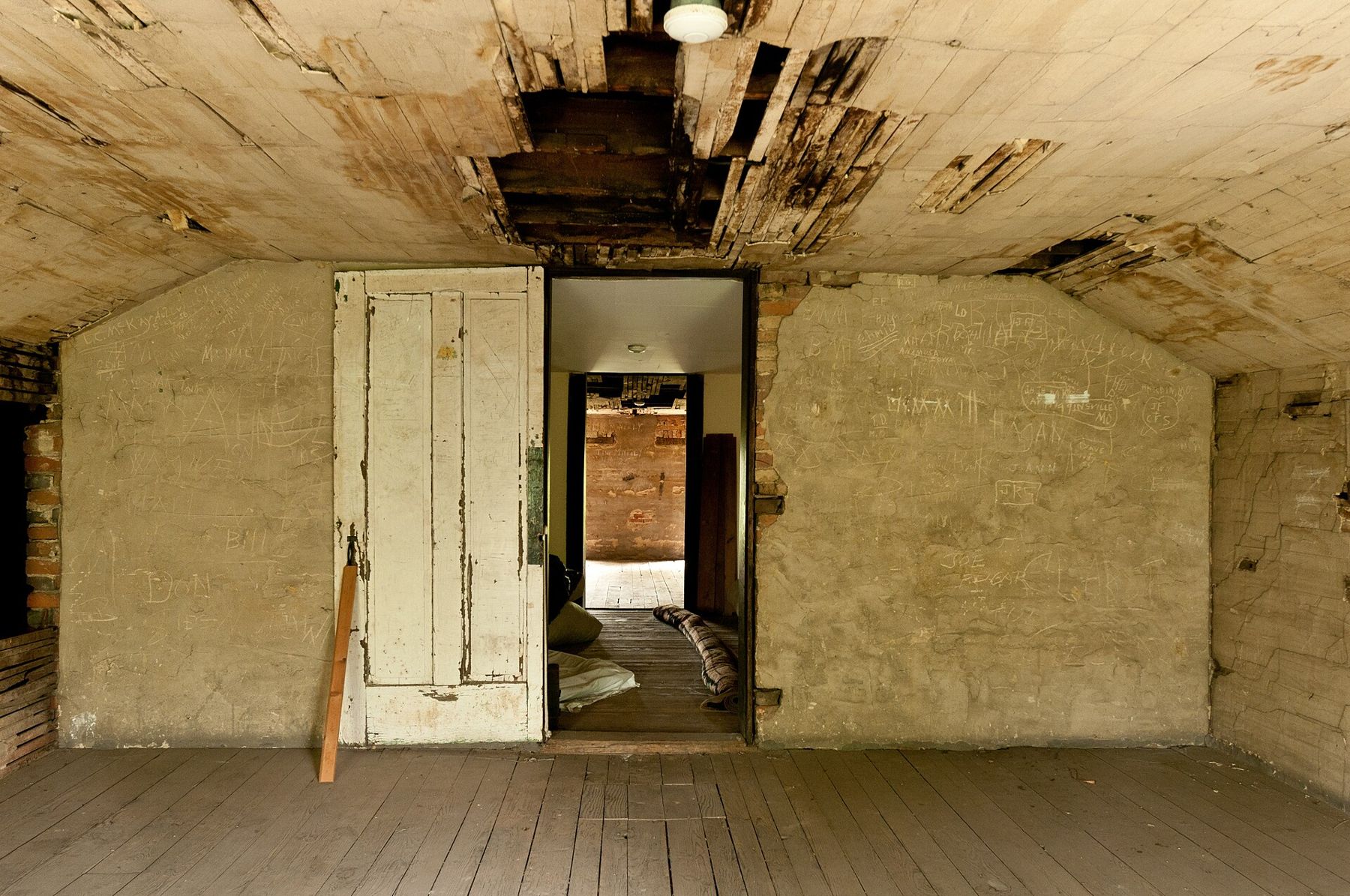
The Anderson House is the centerpiece. Built in the early 1850s by Oliver Anderson, who made his money in hemp, it is a big Greek Revival house of three stories. Inside, you can still see bullet holes in the walls and woodwork and damage from the fighting, alongside rooms furnished in the style of the period. Guided tours run on a schedule that changes with the season, and there is a fee for the house. Check before you go.
The courthouse and the old town
A few blocks south, the Lafayette County Courthouse stands on Main Street. Built in the late 1840s, it is among the oldest courthouses still in use west of the Mississippi. During the siege a cannonball struck one of its front columns and stayed there. It is lodged high in the column today, and you can see it from the sidewalk without going inside.
The streets around the courthouse are worth a slow walk. Lexington kept a remarkable number of antebellum houses and churches, many of them along the streets climbing the bluff, and the commercial blocks downtown date from the river years and the decades after. Look for the old college buildings, the brick churches and the iron fronts on the business streets. At the edge of downtown stands one of the twelve Madonna of the Trail statues, put up in 1928 along the national old-trails road to honor pioneer women.
Below the bluff, the river landing that made the town is mostly gone from view. The Missouri has been narrowed and channeled since the steamboat years, the bottoms are farmed, and the old wharf district has faded. Lexington's story of a river that shifted and floods that remade the waterfront is the same one told along this whole stretch, from Weston upriver to the towns below.
Lexington and the river towns
If you are following the river downstream from Kansas City, Lexington fits naturally after a stop at Parkville and before the villages of the Boonslick country. The same steamboats that loaded hemp here carried passengers and freight up to Weston and down to St. Louis, and one of them, lost in 1856 near Parkville, now sits in a Kansas City museum as the steamboat Arabia.
The story of the siege also belongs to a larger and harsher one. The fighting along the Missouri-Kansas line began years before 1861, with raids over slavery in the Kansas Territory, and it ended years after, with guerrilla war and the forced clearing of border counties in 1863. Lexington's courthouse and battlefield are some of the easiest places to see that war on the ground.
Planning a visit
- Getting there: Lexington is about an hour's drive east of Kansas City on US 24, or by Highway 13 from I-70.
- Time: allow two to three hours for the battlefield and the Anderson House, and another hour for the courthouse and a walk through town.
- Season: spring and fall are the most comfortable for walking the open field. Summer afternoons on the bluff are hot and exposed.
- Hours and fees: the state historic site sets its own schedule and tour times, and they change through the year. Check before you go.
Bring water and a hat in warm weather. The field has little shade, and that, as the garrison learned in 1861, is a long way from the river.
Notice
Notice: the siege ground above the river is open to walkers. Look for the trenches, the bullet-scarred house and the iron ball lodged in the courthouse column.